UN
7 Reade Road
£ 430,000
Description
We don't have a Description for this property.
- Bedrooms
- 3
- Bathrooms
- 0
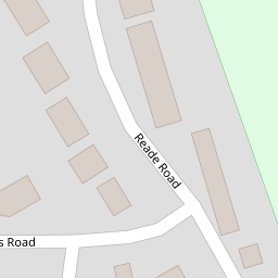

Leaflet © OpenStreetMap contributors
The heatmap indicates the level of crime in the area. The color of the heatmap indicates the crime severity and recency.
Metrics Year-on-Year
- Average area value
- 211,429.00 £Decreased by 18.26 %
- Average area rental value
- 764.00 £/moDecreased by 28.26 %
- Est rental Yield
- 4.34 %Decreased by 12.15 %
- Crime Rate
- 83.00 %Unchanged by 0.00 %
from 258,676.00 £
from 1,065.00 £/mo
from 4.94 %
from 83.00 %
Nearby Schools
| Name | Type | Ofsted | Distance |
|---|---|---|---|
| Holbrook Primary School | Community School | Good | 0.33 KM |
| Holbrook Academy | Academy Converter | Good | 0.59 KM |
| Royal Hospital School | Other Independent School | 1.44 KM | |
| Stutton Church Of England Primary School | Academy Sponsor Led | 3.01 KM | |
| Tattingstone Church Of England Voluntary Controlled Primary School | Voluntary Controlled School | Good | 4.83 KM |
Images
Nearby Streets
| Name | Average Price | Average Sqft | Distance |
|---|---|---|---|
| Berners Field | £ 0 | 0 | 0.00 KM |
| Woodlands Road | £ 0 | 0 | 0.00 KM |
| Wagstaff Close | £ 1,750,000 | 0 | 0.00 KM |
| B1080 | £ 775,000 | 0 | 0.00 KM |
Nearby Transport
| Name | NLC | TLC | Distance |
|---|---|---|---|
| Wrabness | 6907 | WRB | 5.38 KM |
| Ipswich | 7217 | IPS | 7.43 KM |
| Derby Road (Ipswich) | 7212 | DBR | 8.01 KM |
| Mistley | 6906 | MIS | 9.21 KM |
Nearby Listings
| Address | Price | Type | Score | Distance |
|---|---|---|---|---|
| Clifton Wood, Holbrook, Ipswich, Suffolk, IP9 | £ 350,000 | BUY | 6 / 10 | 0.16 KM |
| Reade Road, Holbrook | £ 360,000 | BUY | 6 / 10 | 0.17 KM |
| Clifton Wood, Holbrook, Ipswich, Suffolk, IP9 | £ 450,000 | BUY | Unknown | 0.19 KM |
| Reade Road, Holbrook | £ 260,000 | BUY | 5 / 10 | 0.19 KM |
| Heathfield Road, Holbrook, Ipswich, Suffolk, IP9 | £ 395,000 | BUY | 7 / 10 | 0.29 KM |
Nearby Properties
| Address | Price | Distance |
|---|---|---|
| 11 Reade Road | £ 267,000 | 0.00 KM |
| 5 Reade Road | £ 470,000 | 0.00 KM |
| 28 Reade Road | £ 172,500 | 0.00 KM |
| 22 Reade Road | £ 290,000 | 0.00 KM |
| 23 Reade Road | £ 185,000 | 0.00 KM |